
What Is Marketing Geoanalytics?
Marketing geoanalytics is the practice of analysing location data — where customers live, where they shop, where competitors are based — to inform marketing and business decisions. It answers questions a demographic profile alone can’t: not just who a business’s customers are, but where they actually are relative to a store, a delivery radius, or a competitor’s location. The foundational idea behind much of this analysis goes back decades: a trading area isn’t a fixed circle around a location, it’s a probability that shrinks the further a customer has to travel, a principle formalised in an early gravity-model study of retail trade areas (Huff, 1964) that still underpins modern geomarketing tools.
The Distance-Decay Principle
Distance decay describes a consistent pattern: the likelihood that a customer visits a given location falls as the distance they’d need to travel increases, though not at a constant rate — the drop-off is steepest close to the boundary of what customers consider convenient, then levels off for anyone truly far away who was unlikely to visit regardless. This is why trade areas are properly modelled as overlapping probability zones rather than as neat non-overlapping circles drawn around each store: two competing locations a few miles apart both realistically draw customers from much of the same territory, just with different odds of winning each customer’s visit.
Primary, Secondary and Tertiary Trade Areas
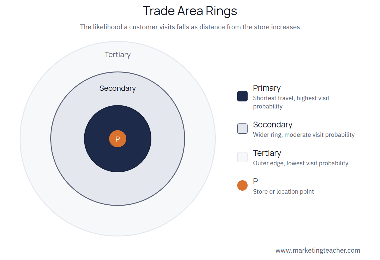
Geoanalytics conventionally splits a trade area into three rings around a location. The primary trade area is the closest ring, typically accounting for the majority of a location’s customers and representing the shortest, most convenient travel distance. The secondary trade area is a wider ring further out, drawing a smaller but still meaningful share of customers who are willing to travel further for a specific reason — better selection, a lower price, or simply having no closer alternative. The tertiary trade area is the outermost, lowest-probability ring, capturing occasional customers who are effectively drawn from the edge of the market rather than being a location’s realistic core audience.
What Marketing Geoanalytics Is Used For
Beyond mapping existing trade areas, geoanalytics informs decisions before a business commits money to them. Site selection uses it to test whether a proposed new location’s trade area overlaps too heavily with an existing store, which would mean the new location largely cannibalises the old one rather than reaching new customers. Geofenced marketing uses it to trigger an offer or an ad specifically to people who cross into a defined radius around a physical location. Competitive analysis uses it to see how much of a market a competitor’s trade area actually overlaps with a business’s own, which shows where genuine head-to-head competition is happening and where it isn’t.
Drive Time Beats Straight-Line Distance
An early, simple version of trade-area mapping draws rings as straight-line distances — three miles, five miles, ten miles — regardless of what’s actually between the location and the customer. Modern geoanalytics tools instead model drive-time or travel-time bands, because a customer six minutes away by a direct main road is a far more realistic visitor than one three miles away across a river with no direct bridge, or on the far side of a highway with no easy crossing. A rural location’s realistic ten-minute drive-time area can be many times larger than an urban location’s ten-minute area, simply because urban traffic and street layout slow travel down — a difference a straight-line-distance ring would completely miss, and one that can meaningfully change which of two candidate sites is the stronger choice.
Data Quality Is the Real Constraint
Geoanalytics is only as reliable as the location and customer data feeding it. Loyalty-programme addresses, mobile location data, and delivery records all carry biases: loyalty data over-represents existing customers and says little about people who haven’t shopped there yet, and mobile location data can be sparse in areas with lower smartphone or app usage. Treating any single data source as a complete picture of a market — rather than one useful input to be checked against others — is the most common way a geoanalytics-driven decision goes wrong in practice.
Summary
Marketing geoanalytics analyses where customers and competitors actually are in relation to a business location, built on the distance-decay principle that a trade area’s pull weakens the further a customer has to travel (Huff, 1964). Splitting that area into primary, secondary and tertiary rings shows where a location’s real customer base sits, and this same approach informs site selection, geofenced marketing, and competitive analysis before money is committed to a decision. Like any location-based analysis, its value depends on the quality and breadth of the underlying customer and location data feeding it.
The slides, worksheet, lesson plan and poster for this lesson are free to download and free to use in your course — no sign-up, no permission needed. See the teacher resources →
Assign this lesson to your class:
Using Canvas, Blackboard or Moodle? Copy the link and paste it into your course page or assignment. More ways to add lessons to your LMS.

